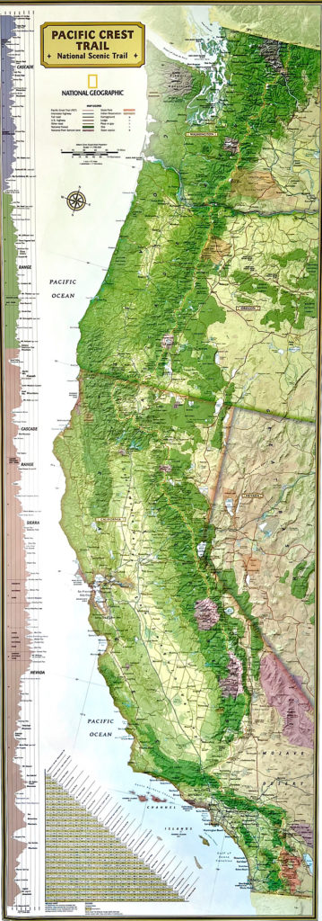
I love this map because it shows the elevation of the path on the left border of the image. The trail truly goes over the crest, the ridge, of mountain ranges created by tectonic plates colliding. The same process which caused the great San Francisco earth quakes.
That makes me feel small and realize we’re part of something bigger.
The map underneath shows a more clear overview of the trail. Also amazing to see how large the state California is. To cross the state from the border of Mexico is a 2723 kilometres hike. Only then I’ll reach the next state, Oregon… I hope I will make it there and if so, I hope I will have the stamina to continue 🙂